
Biodiversity mapping tools
for site scoping, monitoring, and reporting
From rapid site scoping to portfolio-scale monitoring and reporting, we classify habitats to recognised standards to support nature-positive planning, nature-related risk, and TNFD-aligned reporting.
.webp?width=1540&height=558&name=GFSA_DigitalBadge_withoutyear_2024%20(1).webp)

What we do
Gentian provides AI technology trained to read very-high resolution satellite images and map biodiversity across habitats worldwide.
Our tools go beyond simple vegetation mapping, enabling organisations to classify habitats, monitor invasive species, quantify biodiversity, and identify opportunities for ecological uplift.

How it works
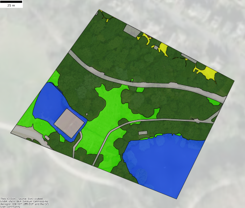
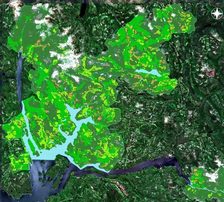
After selecting your site, we acquire very high-resolution satellite imagery for analysis. Our advanced AI models generate detailed habitat data, which is verified by our experts. You receive expert-verified results within days—or even minutes—through our online platform.
%20(1).png?width=1920&height=1080&name=Website%20Graphics-1%20(2)%20(1).png)
 Biodiversity Assessment
BNG Assessment
Phase 1 Habitat Surveys
Ecological Surveys
Habitat Mapping
 Nature-related Reporting
TNFD Reporting
CSRD Compliance
Comply confidently with the Corporate Sustainability Reporting Directive (CSRD) using our solutions that offer accurate, transparent data for sustainability reporting.
Monitoring Reporting and Verification (MRV)
ESG Reporting
BNG Assessments
 Nature Restoration & Conservation
Peatland Mapping & Assessment
Obtain high-resolution insights into peatland extent and conditions, enabling targeted restoration and conservation efforts.
Tree Surveys
 Urban Biodiversity & Climate Resilience
BNG Assessments
Monitoring Reporting and Verification (MRV)
Tree Surveys
Learn more

Gentian True Sight
Instant Biodiversity Net Gain (BNG) assessments. Rapid AI-powered habitat mapping software compatible with BNG metrics. Ideal for quick site screening and feasibility studies.
.png?width=952&height=671&name=unnamed%20(4).png)

Gentian True Sage
Detailed habitat assessments and monitoring. Comprehensive biodiversity mapping software with high precision and accuracy, designed for nature-positive reporting, planning, and ongoing monitoring.

Gentian True Oracle
Bespoke enterprise biodiversity intelligence. Tailored AI-driven environmental insights and custom solutions for complex, large-scale ecological and sustainability challenges.
.png?width=2048&height=690&name=unnamed%20(2).png)

Gentian True Urban
Urban green infrastructure analysis. Detailed mapping of urban habitats, green roofs, and climate resilience to support sustainable city planning and development.

Globally scalable
Apply biodiversity MRV across sites around the world.

Fully remote
No fieldwork delays or seasonal constraints.
.png?width=96&height=96&name=icons8-pass-96%20(1).png)
Aligned with frameworks
Output formats compatible with TNFD, SBTN, and CSRD.
.png?width=100&height=100&name=icons8-trust-100%20(1).png)
Trusted expertise
Data reviewed by ecologists and GIS analysts.
Why Gentian
Led by experts in ecology, remote sensing, and artificial intelligence, our biodiversity mapping software makes the invisible visible by illuminating the risks and opportunities associated with your organisation’s impact on the environment. Leaders powered by Gentian are better equipped to manage nature-related risks, meet stakeholder expectations, and lead innovation in sustainability.


Latest News & Articles

BNG 0.2ha Exemption 2026: Is Your Site Still In Scope?

The latest on the landmark EU Deforestation Regulation (EUDR) and more
-1.png?width=400&height=250&name=Sans%20titre%20(7)-1.png)
Do I Need an Ecological Survey? The Top 5 Questions Every Business Should Ask
.jpg?width=400&height=250&name=dominik-vanyi-Mk2ls9UBO2E-unsplash%20(1).jpg)